Agriculture & Climate · 2026
Bhumi
Crop health investigation from satellite imagery with tamper-evident field records
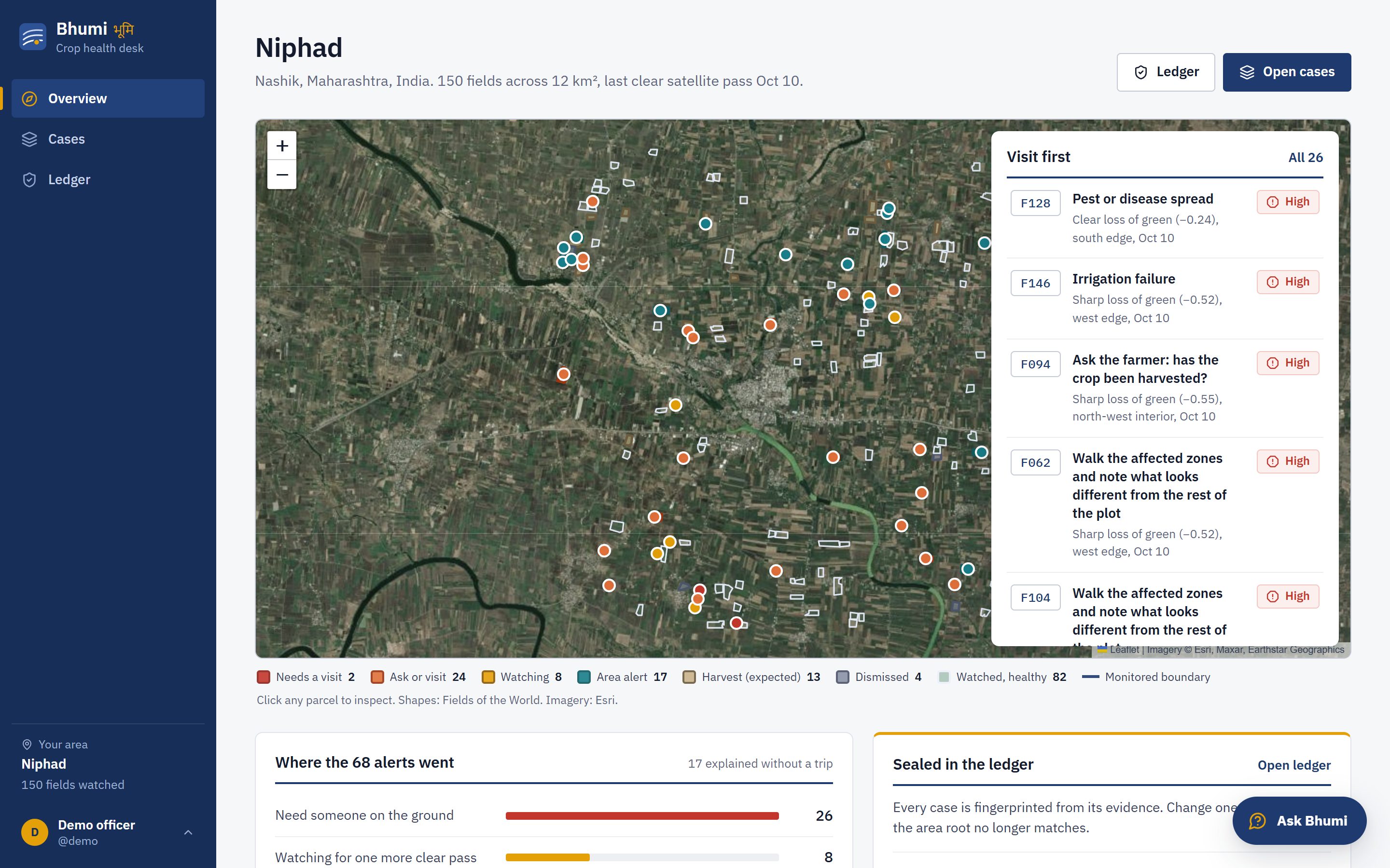
Satellites flag the field. Bhumi says why, names the one check that settles it, and seals the evidence so nobody can quietly change it later.
Sentinel-2 photographs every field on Earth about every five days for free, but a red patch is not a diagnosis. It could be cloud, a harvest on schedule, a district-wide heatwave or a failing drip line on one farm. Field officers who look after hundreds of farms cannot visit every alert, so they stop trusting the alerts.
Monitoring records are also easy to bend: kept in an ordinary database, they can be edited after the fact or claimed twice. Bhumi uses satellite imagery, weather data and verifiable field records to detect crop stress, identify probable causes and recommend the next best field check, and it seals the evidence.
What it does
- Runs on real Sentinel-2 imagery and Open-Meteo weather for 150 fields in Niphad, Nashik (Maharashtra)
- Diagnoses likely causes instead of just flagging lost greenness
- Recommends the single field check that settles each case
- Tamper-evident evidence ledger for monitoring and verification schemes
Built with
- Python
- Sentinel-2
- Open-Meteo
- Geospatial analysis